Hello everyone! I am so excited to be participating in my first element14 design challenge so thank you for the opportunity! Until the parts arrive in the mail, I thought I’d introduce everyone to my design and a bit of background information.
Introduction
When wildfires rage, the flames aren’t the only danger that we face. Along with harmful gasses and heat waves, particulate matter (PM), is also released into the atmosphere. This particulate matter is harmful to human health. Tracking the particulate matter more closely will help inform public safety measures by predicting where and when regions will be affected. My solution is a particulate matter tracking system mounted on a drone. This device will experience severe wind, weather, heat, and particulate matter bombardment, which will require a robust and reliable system enclosure. I hope the Hammond enclosures are up to the challenge!
The Problem
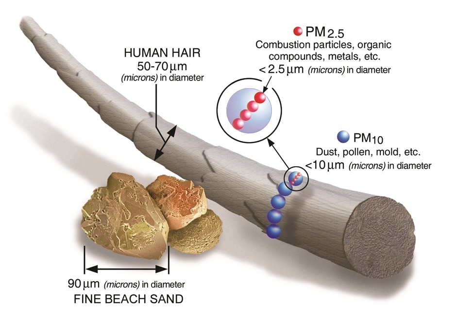
Particulate matter are super tiny solid and liquid particles that are way smaller than the width of a human hair (see Figure 1 below). Although PM can be released into the air from many different sources, I will be focusing on PM from smoke due to forest fires. Particulate matter categories PM10 and PM2.5 are particles that have diameters less than 10 microns (μm) and 2.5μm, respectively. PM2.5 is of particular interest because these particles can be inhaled deep into the lungs and even enter the bloodstream. This is obviously not good and can cause serious health effects.

Figure 1: Size of Particulate Matter (EPA)
The Proposal
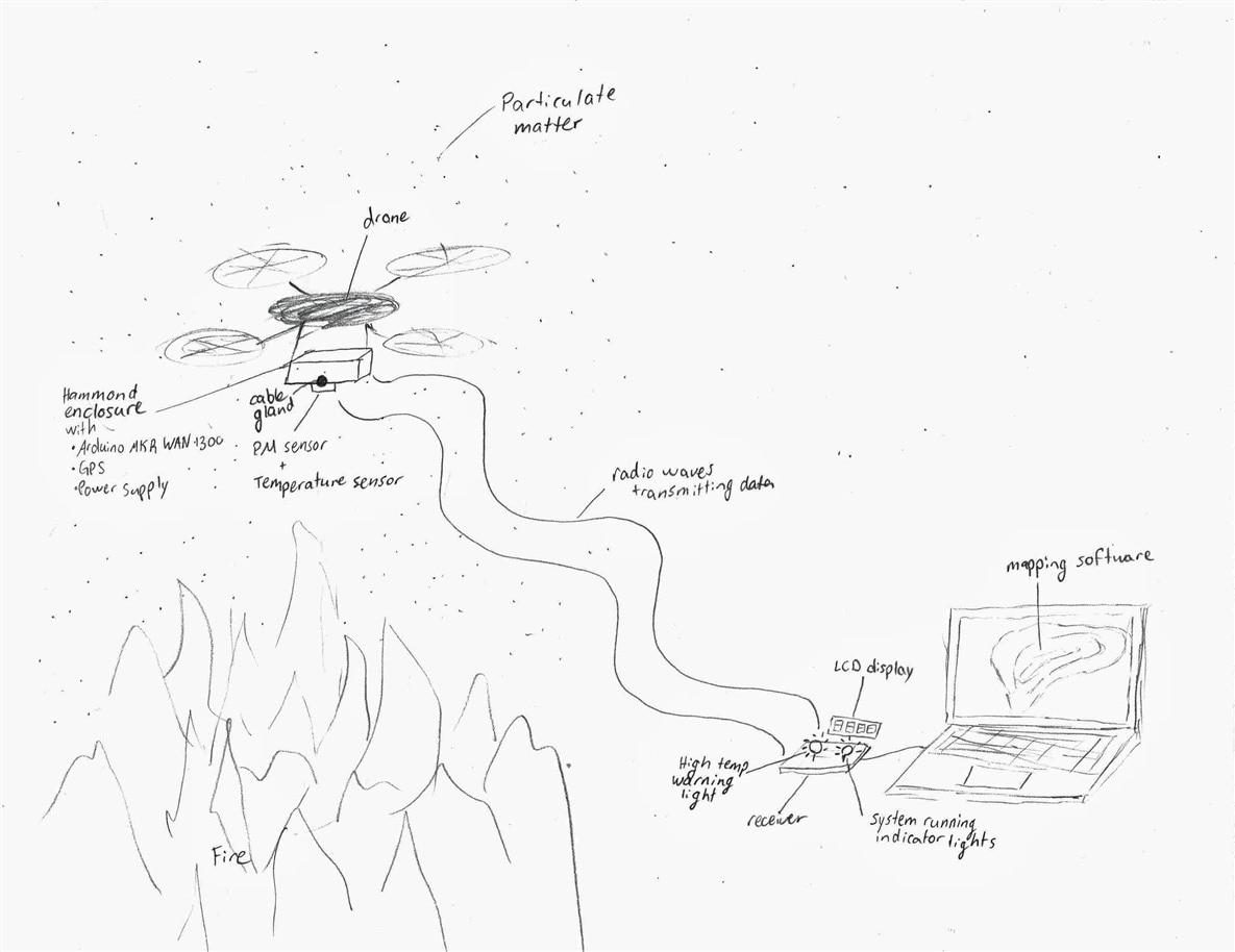
In order to get high resolution data of PM released from forest fires, I will be designing a drone-mounted PM sensor encased in a heat and weather resistant enclosure (Figure 2 shows a sketch of my concept design). This system will be able to fly close to fires in a preprogrammed grid flight pattern at multiple elevations. The PM data collected from this device will be mapped with GPS location coordinates to create a 3D visual of the plume! The data will be transmitted using an Arduino MKR WAN 1300 in real time to a receiver on the ground up to six miles away. The map of the particulate matter can be used for research into PM due to forest fires and to inform public health measures by tracking and predicting which communities the PM will impact.

Figure 2: Design Concept Sketch
Now obviously I can’t get that close to a forest fire in the middle of winter in New Brunswick, Canada, and even if I could, my brother’s recreational drone can only operate at temperatures up to 105°F (40°C). But don’t despair! I will still be putting my design through rigorous tests over a campfire. And since it will be the middle of winter, the Hammond enclosures will have to deal with freezing air temperatures, hot fire temperatures, as well as particulate matter bombardment!
If my design works, I would love to see it taken to the next level and mounted on a firefighting drone so it can actually enter the high heat zones of forest fires and be used in a real-world application.
Conclusion
I believe the Hammond weatherproof enclosures combined with the Arduino MKR WAN 1300s will work very well for my drone-mounted particulate matter sensor in the application of PM tracking due to wildfires. I am excited to apply my various skills and experiences to this challenge and share this design journey with the world!
