


Hi all,
On Bonesnapper Ridge, I have a fairly large system for storing water and I would like to monitor the entire system. This topic started to take off on another thread, so I thought I would make a new post to keep it all in one place and give a little more background.
Wells
There are multiple wells on the property, but I am focused on three of them. These are "horizontal wells" or tapped springs. They are drilled horizontally into the side of the hill and are gravity fed to a set of tanks at the bottom of the property. These wells flow 24/7 365 days a year. The wells flow into the tanks, and then there are overflow pipes that overflow into a culvert. As I said, 24/7. Maybe I could install very small turbines on these to generate a little bit of power?
Tanks
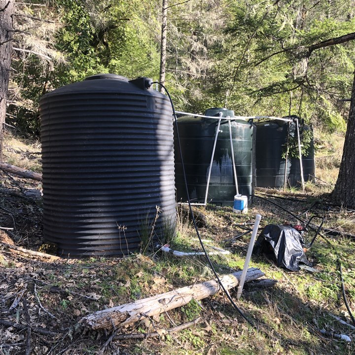
There are two main tank sites on the property. There are three ~2500 gallon tanks at the well site which is at the lower elevation of the property. There are three more ~2500 gallon tanks at the highest elevation of the property. There is also one 2500 gallon tank right in between these two sets of tanks in the middle of the elevation. The bottom tanks are plumbed all the way up to the top tanks and flows through that middle tank. Note: The lower tanks are 100% full until I pump, then it takes about 8 hours to fill up what I pumped out.
Pumping
To get water from the lower tanks to the upper tanks that feed the house/shop, currently, I have to drive down to the lower tanks and fire up a gas-powered honda water pump (currently broken... yay another project!). On a full tank of gas, this can pump something like 1800 gallons. So I would have to pump several tanks of gas worth to fill up the upper tanks. I have to open and close a few valves manually in this process.
Water Usage
I am surprised at how little water I have been using. I don't have laundry up here yet, so that will add a bit, but as of now, it's quite low. Last time I pumped I marked it on the upper tank before I pumped, and then I marked it off after the pump. That's where I came up with the approximate 1800 gallons on a tank of gas. It has been a few months since I have pumped water, and there is still plenty in the upper tanks.
Sensor Data & System Design
My goal at the end of a few projects is to have sensors in each of the tanks ( seven tanks ) and report that back to MQTT or an InfluxDB database here at the house. Build a solar or hydro-powered pumping system at the bottom tanks, so that when the top tanks get below a certain threshold, the pump will automatically turn on and pump water until a threshold is met.
What data do I need out of the tank sensors?
The nerd in me wants it down to the gallon. But that's going to be more difficult to achieve, and in the system design, I don't really need that. I can probably get away with down to the 100 or 1000 gallon. The resolution will determine how often I pump, and the design of the pump system will also be a factor in how often I can pump. for example, if the pump and battery can pump 100 gallons on a full charge, then I have to know how long it takes to gain a full charge on the battery using either solar or hydro. Then I can set my thresholds in the system for how often to pump. I'll probably end up looking at the state of charge of the pump batteries and determining if it can pump as well.
Maybe for now, I will have to settle for somewhere in the middle and have a minimum resolution of 500 gallons. If it's lower than that great, if it's higher? Well, I will just have to deal with it.
The order of execution
I want to get the sensors built first, and then the rest of the monitoring system and the pumping system will come at a later date. I would like to get all of it done this summer, but there is a LOT to do here and it's not critical. But the senors are critical to my data-hungry brain, and sore legs from hiking up the hill to check water levels.
I would love to hear your feedback on this! Some of this topic has been discussed on the thread below, so please check that out.
I will add some pictures first thing tomorrow to this post. I'm in a rush to get out of this house this morning.
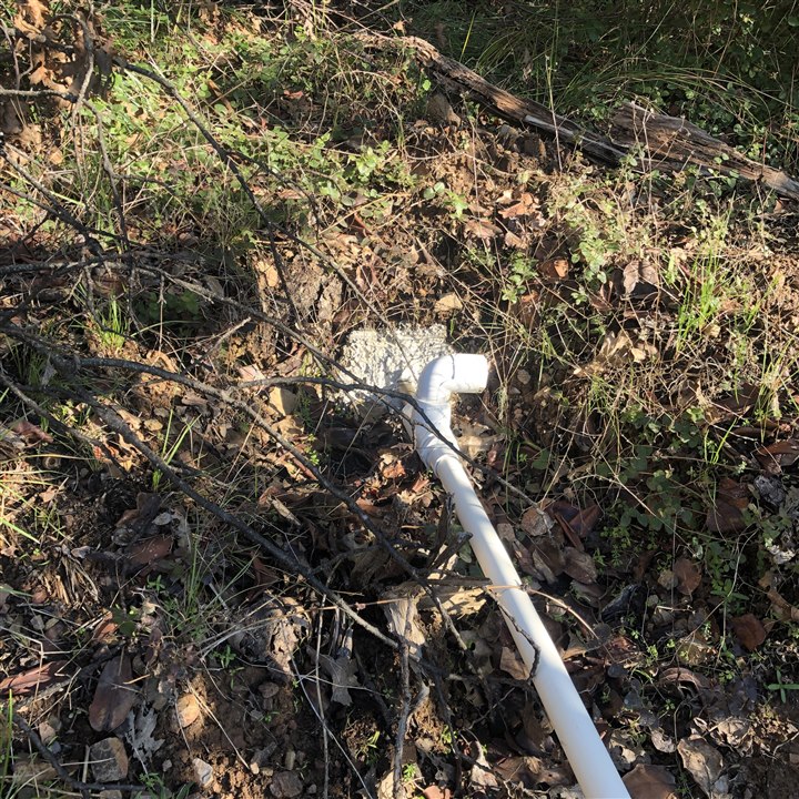
Well and Tank Pictures:
Upper Tanks
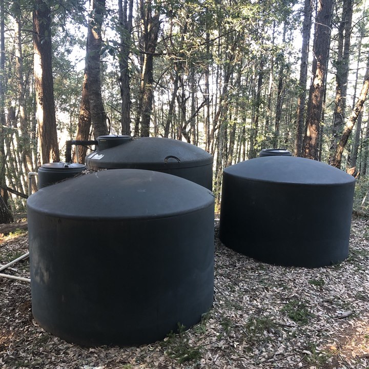
Lower Tanks
Primary Well
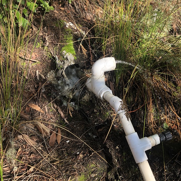
Secondary Well
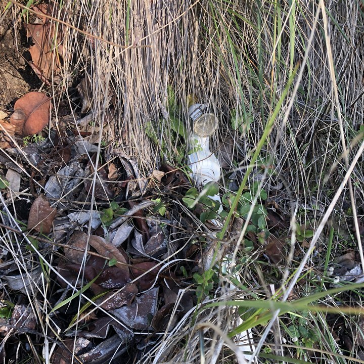
Tertiary Well
The second and third wells are tied together, they do not have as much output as the primary well.
Elevation Data
| Site | Elevation (m) | Elevation (ft) | Barometric Pressure (mb) |
| House | 672.7 | 2207 | 1019 |
| Upper Tanks | 698 | 2290 | 1016 |
| Middle Tank | 646.8 | 2122 | 1022 |
| Primary Solar Site | 628.5 | 2062 | 1024 |
| Lower Tanks | 622.7 | 2043 | 1026 |
| Primary Well | 620.6 | 2055 | 1025 |
| Secondary Well 00 | 626.4 | 2066 | 1024 |
| Secondary Well 01 | 630.6 | 2069 (eyeballed) | 1024 |
NOTE: Updated for the third time.
For this data I took my Garmin 64s out with barometric pressure turned on. When I got the area the elevation would fluctuate wildly starting low, then gradually going up until it stabilized. This took about three minutes. I waited at each site for appx three minutes until it stabilized. I recorded the barometric pressure for Dave.
However, The difference between the "Primary Solar Site" and "Lower Tanks" being ~6' does not seem right. The road from the solar site to the wells and tanks goes downhill for quite a ways, then up just a little. There is no line of sight, and I could be deceived, but I really do not think so. "Lower Tanks" to "Primary Well" seems off as well, data shows ~12', but I think it's more like 5-8'.
Thanks!
-Kaleb


