


Image by Jason Goh from Pixabay
Until earlier this year, urban areas were on a steady path of upward growth and expansion. At the time, more and more people were moving back to cities to live and work. Companies shuttered sprawling suburban campuses and relocated to urban sites to attract top talent and stay competitive.
Once COVID-19 struck, vast numbers of people in the United States and around the world spent the majority of their time at home, periodically ducking out for groceries or a walk around the block. City folk, many living in tight quarters where every square foot counts, started to rethink where and how they wanted to live (and work remotely). According to a June 2020 report by the Stanford Institute for Economic Policy Research, approximately 42% of the U.S. workforce is now working remotely, due in large part to the pandemic. As a result, individuals, couples and families crave square footage, as well as distinctly separate spaces inside their homes. City dwellers, once staunch advocates for the urban lifestyle, have either seriously considered or have already made a move to larger homes with outdoor space farther from the city center or in the suburbs. Since commuting is less of a daily issue, it’s easier for people to make that leap to greener pastures.
With an ever-evolving health crisis and people cooped up in the city or a bit more spread out in the suburbs, the time is ripe for local governments and developers to continue to identify Smart City innovations to increase efficiency and keep people safe.
To successfully launch Smart City planning, experts agree that data, data and more data are the most important aspects to learning how a city currently operates to then make informed decisions on improvements. Data is the beginning, middle and end to identifying opportunities and innovations that can save money, offer conveniences, create efficiencies and set up a city for sustained success.
Here’s a rundown of five innovations the world over that are helping urban developers plan smarter and everyday citizens live better.

Image by StockSnap from Pixabay
Sensors on Lamp Posts to Capture Data
Sounds a little anticlimactic, but devices that capture data are at the heart of developing Smart Cities. Major metropolitan centers around the world, such as Singapore, Hong Kong, Barcelona, Chicago and New York, are mounting sensors and other data-tracking devices on light posts, dumpsters and other fixed objects to capture the all-important data they need to help make decisions and identify innovations. The sensors capture a wide range of data, including “air quality, temperature, traffic, energy consumption in buildings, smog, garbage production, or humidity.” This rich and continuously updated data is uploaded to the cloud and enables each city to construct a “digital shadow” or panorama of the behavior of the city. The data helps waste management departments scale back or increase garbage pickups; environmentalists tackle air pollution; transportation experts modify bus routes and schedules; and so much more.
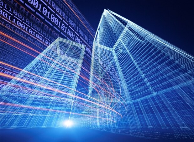
Image by Siemens
Digital Twins for Urban Planning
While the technology isn’t new, the application of digital twin technology for use in urban planning, engineering and other applications is innovative. For instance, urban planners create 3-D maps of the city, coupled with continuously uploaded data from sensors and other devices throughout the area. Planners use the maps and real-time data to plan for future developments, such as building and traffic construction, in a way that minimizes disruption to daily life. In other words, they can run scenarios using digital twins before applying it to the real world. Cities like Singapore, with 8,000 people per square kilometer, are putting this technology to good use to help make decisions for a modern city that’s tight on space.

Image by Spencer Wing from Pixabay
AI to Reduce Traffic Accidents and Streamline Pedestrian Crossing
When applied to crosswalk lights, artificial intelligence can anticipate when a pedestrian wants to cross the street and give “large groups and people with disabilities more time to cross.” A system of cameras mounted on crosswalk lights, “global movement models,” and algorithms tell the light when to change for pedestrians. Dubai has also developed a monitoring system equipped with artificial intelligence that has “greatly reduced traffic accidents caused by fatigue” in bus drivers.

Image Source: Royal College of Art
Floating Homes for Coastal Communities
London-based art school graduate student Wojciech Morsztyn envisions an “Ocean Community” where two-story, mobile, floating homes are tethered together and connected via walkways. The communities are meant to be located near the coast so that they have access to the mainland for work and play and other city amenities. The floating homes address growing concerns over rising sea levels and tackle climate change by using a combination of solar, wind and conventional electrical energy. Each structure also filters and stores water for in-home use. Morsztyn believes development and implementation could happen by 2035 and hopes to bring the price per home as low as £150,000 or $195,495.

Image by Gerd Altmann from Pixabay
Digitalization of Government Services
Dubai 2021 is a 3-year plan orchestrated by the most populous city in the United Arab Emirates. The plan is to “digitalize all government services, including some 100 initiatives encompassing transport, communications, infrastructure, electricity, economic services, and urban planning.” As of early 2020, nearly 90 services had been digitalized and could be accessed through the DubaiNow app. The city hopes to save paper, money and other resources in moving toward digitalized services.
Have a story tip?
Message me here: http://twitter.com/Cabe_Atwell