element14 Community
element14 Community
    Register Log In
  • Site
  • Search
  • Log In Register
  • Community Hub
    Community Hub
    • What's New on element14
    • Feedback and Support
    • Benefits of Membership
    • Personal Blogs
    • Members Area
    • Achievement Levels
  • Learn
    Learn
    • Ask an Expert
    • eBooks
    • element14 presents
    • Learning Center
    • Tech Spotlight
    • STEM Academy
    • Webinars, Training and Events
    • Learning Groups
  • Technologies
    Technologies
    • 3D Printing
    • FPGA
    • Industrial Automation
    • Internet of Things
    • Power & Energy
    • Sensors
    • Technology Groups
  • Challenges & Projects
    Challenges & Projects
    • Design Challenges
    • element14 presents Projects
    • Project14
    • Arduino Projects
    • Raspberry Pi Projects
    • Project Groups
  • Products
    Products
    • Arduino
    • Avnet & Tria Boards Community
    • Dev Tools
    • Manufacturers
    • Multicomp Pro
    • Product Groups
    • Raspberry Pi
    • RoadTests & Reviews
  • About Us
  • Store
    Store
    • Visit Your Store
    • Choose another store...
      • Europe
      •  Austria (German)
      •  Belgium (Dutch, French)
      •  Bulgaria (Bulgarian)
      •  Czech Republic (Czech)
      •  Denmark (Danish)
      •  Estonia (Estonian)
      •  Finland (Finnish)
      •  France (French)
      •  Germany (German)
      •  Hungary (Hungarian)
      •  Ireland
      •  Israel
      •  Italy (Italian)
      •  Latvia (Latvian)
      •  
      •  Lithuania (Lithuanian)
      •  Netherlands (Dutch)
      •  Norway (Norwegian)
      •  Poland (Polish)
      •  Portugal (Portuguese)
      •  Romania (Romanian)
      •  Russia (Russian)
      •  Slovakia (Slovak)
      •  Slovenia (Slovenian)
      •  Spain (Spanish)
      •  Sweden (Swedish)
      •  Switzerland(German, French)
      •  Turkey (Turkish)
      •  United Kingdom
      • Asia Pacific
      •  Australia
      •  China
      •  Hong Kong
      •  India
      • Japan
      •  Korea (Korean)
      •  Malaysia
      •  New Zealand
      •  Philippines
      •  Singapore
      •  Taiwan
      •  Thailand (Thai)
      • Vietnam
      • Americas
      •  Brazil (Portuguese)
      •  Canada
      •  Mexico (Spanish)
      •  United States
      Can't find the country/region you're looking for? Visit our export site or find a local distributor.
  • Translate
  • Profile
  • Settings
Wireless
  • Technologies
  • More
Wireless
Blog How We Lost Flight MH370
  • Blog
  • Forum
  • Documents
  • Polls
  • Quiz
  • Events
  • Mentions
  • Sub-Groups
  • Tags
  • More
  • Cancel
  • New
Join Wireless to participate - click to join for free!
  • Share
  • More
  • Cancel
Group Actions
  • Group RSS
  • More
  • Cancel
Engagement
  • Author Author: kas.lewis
  • Date Created: 17 Mar 2014 8:54 PM Date Created
  • Views 2422 views
  • Likes 3 likes
  • Comments 8 comments
Related
Recommended

How We Lost Flight MH370

kas.lewis
kas.lewis
17 Mar 2014

As we go into another day wondering where Malaysian Airlines MH370 is, the biggest question is: how does such a big airplane vanish with no apparent trace? But first we need to understand how airplanes are tracked today.


9M-MRC-Malaysia-Airlines-Boeing-777-200_PlanespottersNet_286025.jpg


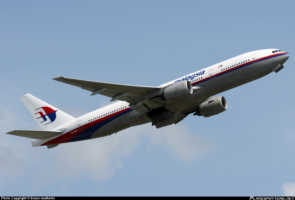
The 777 is one of Boeing’s most advanced aircraft with some of the most up-to-date communication equipment on board. There are four primary methods of communication with an airplane. The first is the standard method of radio communication. This is where the pilot informs air traffic control of his position and altitude verbally.


The second method of communication is via radar, in this category there are two types. The first is primary radar, this is simply the radio reflection of the airplane (sort of like the way a flashlight lights up an object in a dark room). While the commercial version of this first type of radar may tell you how far an airplane is from the ground station, it does not convey altitude or airspeed, for this secondary radar is used. Secondary radar sends a signal to the airplane asking it for more information. Since the direction from which the signal was sent is known, the general direction of where the airplane is is also known. When the airplane’s onboard transponder sends back information (altitude, airspeed, etc) then the complete picture is displayed on the air traffic controller screen (ATC): position, altitude, and airspeed.

spaceout.gifsonar-scope-7392911.jpg

The third method of communication is starting to become more mainstream and will become required by the FAA by 2020. This is called Automatic Dependent Surveillance-Broadcast (ADS-B). With ADS-B, more information is transmitted back to the ground station and does not depend on ground-based stations for receiving/transmitting data. It is connected via satellite to any necessary ground station. The benefits of this are obvious when we look at flight MH370 and a bit further back at Air France 447. With AF477 it was not known that the flight had a catastrophic event until at least 2 hours later, when it was supposed to be flying over Senegal. The reason for this is that flights routinely “vanish” from their digital tracks. When a flight leaves a radar-controlled space, say, flying across the Atlantic where there is no real-time radar tracking, the flight’s last known position, airspeed, and planned flight path are used to predict its progression along its route. When the flight arrives again at a radar controlled zone it is supposed to check in. In AF477’s case, when the first ATC failed to get an acknowledgment from the flight’s pilots, he assumed they either did not hear him or they were busy. It was only when a later ATC in Senegal looked further into the matter (when he, too, failed to get an acknowledgment) that it was discovered that AF477 had had a catastrophic event. This is something the ADS-B would remedy. Even with a transmission rate of once per 30 minutes, it would still offer far greater accuracy to determine where a flight truly is.


The last method of communication between the ground and an aircraft is something called Aircraft Communications Addressing and Reporting System (ACARS). ACARS is a text-based system that allows the airplane and pilots to send information to the aircraft manufacture and airlines headquarters to report anything from routine maintenance issues to possible weather alerts along the flight path. The ACARS can also be used as a kind of “are you alive” signal since it apparently can not be turned off. In the MH370’s case it is this signal that has led investigators to believe that the plane flew for more than 5 hours after all other forms of flight tracking were turned off since this signal was repeatedly received hourly between 4 and 6 times after the flight vanished.


With all these communication systems in place one would think that it would be difficult for a plane to completely disappear. According to the current assumed flight path, it is thought that the plane flew back over Malaysia and possibly over mainland Asia. So how does a plane just disappear? Even if all onboard systems could be turned off, couldn’t radar track it since the plane was apparently flying over land and in some cases even through militarized areas?


Let’s start with the onboard communication devices: the transponder, the radio and the ADS-B. These can all be turned off, except for the ACARS. Far from being bad design, this is a necessary safety requirement. In the event of a short circuit that could lead to a fire all systems on board need to have the ability to be shut down. So if the onboard systems were turned off why did no one notice? The answer to this is based on how flights are tracked when out of range of radar. Above it was explained that when a flight leaves a radar-controlled zone it is tracked virtually, that its last known position, airspeed, altitude and flight plan are used to predict where it is at any given moment. This projection is used until the aircraft arrives back in a radar-controlled zone.


image


OK, so all major tracking systems are turned off,. But why can't they see the flight on radar? The answer here is one that might be a bit surprising. In civilian air traffic control towers, most controllers turn off the primary radar reflection to remove clutter. Clutter like: birds, clouds--  anything that the radar picks up but may not necessarily be an airplane. So to get a clearer picture of what is really important, air traffic controllers turn off the primary image and leave the secondary image, which displays all confirmed flights in the area. This does not, however, mean that military installations in the area won't see you. But in Malaysia, India and other countries in the area, military radar is only turned on when there is a good reason, such as a perceived threat. There is also the possibility that someone with knowledge could fly around or under military radar. The aircraft would need to fly under 5000 feet to pull this off-- no simple task, but also not impossible.


So now that we have evaded both civilian and military radar operators, what do we do with the plane? This is one of the bigger issues with this theory, but even this is not impossible to speculate about. In an emergency, the Boeing 777 has the ability to land on a relatively small runway that may or may not be paved. It has been stated that even a well-packed dirt runway could potentially be used. For someone that has worked out how to get a plane this far, getting it on the ground would hardly be a difficult task.


The real frightening question is with a plane full of people on a remote air strip somewere, what do you do with these people? I hope and pray that nothing barbaric or inhumane took place.


Now that we have a potential scenario of how a plane just vanishes, how do investigators have any idea where the plane may be? This is where the ACARS has proven useful. It reports back to the plane manufacturer on routine maintenance issues as well as engine operating conditions. This information is used to monitor the health of an aircraft even before it is brought in for inspection. Although this is a paid service and not all airlines use it (Malaysian Airlines apparently does not pay for this service) it is still a useful system. It’s the same reason many cell phones work both in their immediate service area, and also in new areas: phones respond to requests for information even if the request comes from a different service provider. In the case of the ACARS the system sends out a ping to all radios even if that particular plane is not subscribed to the service. The onboard system then responds with an acknowledgement of the ping. It is this information that investigators have used to give a radius of where the flight may have ended up. This is calculated by taking how long it took from the time the signal was sent out to the time the acknowledgment was received, half of this time is the distance to the airplane. The limitation with this is that it still gives a very large search area-- tens of thousands of miles-- even if remaining flight time is taken into account based on available fuel. We’re still talking about a vast area.


image


So how can we use this information to prevent a plane from vanishing in future? I believe the ACARS system is the answer to preventing planes from vanishing. When a plane responds to a remote ping, it must reply in a standard format. Adding a few more fields to the message would add very little overhead and cost to the existing system, and could provide GPS location information of the flight. This would narrow a search from hundreds of thousands of square miles down to hundreds of square miles. In the case of flight MH370, it would have told us where the plane had been over its last 5 hours of flight, which would have significantly reduced its current search radius.


What do you think? I’d love to know what you think could help improve aircraft location technology. Post your thoughts below in the comments.


Tweet

Follow @Kazzzzzzzzzzz

Follow Kas' blog
  • Sign in to reply
Parents
  • DAB
    DAB over 11 years ago

    We have the technology to have a recorded track of every aircraft that flies.

    GPS is available world wide.  It is very easy to put a GPS receiver into a box and install it on every aircraft with a wifi link to the nearest airport/cell tower.

    It would then be easy to tie in the ignition switch so that you can NEVER turn off the location signal.


    After that, you just tie in tracking software for every aircraft with an instant alert if it veers off track or does anything unexpected.

    There should be no reason for an aircraft to fly below radar.


    Hopefully, no matter how this mystery plays out we have rules enacted to make 100% track of all commercial aircraft mandatory.


    Just my opinion,

    DAB

    • Cancel
    • Vote Up 0 Vote Down
    • Sign in to reply
    • More
    • Cancel
Comment
  • DAB
    DAB over 11 years ago

    We have the technology to have a recorded track of every aircraft that flies.

    GPS is available world wide.  It is very easy to put a GPS receiver into a box and install it on every aircraft with a wifi link to the nearest airport/cell tower.

    It would then be easy to tie in the ignition switch so that you can NEVER turn off the location signal.


    After that, you just tie in tracking software for every aircraft with an instant alert if it veers off track or does anything unexpected.

    There should be no reason for an aircraft to fly below radar.


    Hopefully, no matter how this mystery plays out we have rules enacted to make 100% track of all commercial aircraft mandatory.


    Just my opinion,

    DAB

    • Cancel
    • Vote Up 0 Vote Down
    • Sign in to reply
    • More
    • Cancel
Children
  • mcb1
    mcb1 over 11 years ago in reply to DAB

    Sorry guys, you're way out of your league here, and a few of the bits of info aren't 100% correct.

    I'd also be careful referencing dubious articles that are published on the internet. You would be better served by searching the official investigation documents which should be public.

    While I feel for the families, and it is very tragic, I think you're jumping ahead before you know all the facts.


    Firstly, SSR transponders work with the radar for about 250nm, after that they aren't seen.

    When you turn them off, they aren't able to communicate.

    The transponder is switched off on the ground or in the case of faults.


    Even if you removed the switch you still have a fuse/breaker that needs to be accessible for cockpit fire/smoke.

    It's not like a car where you can just pull over to the side of the road and stop.


    ACARS relies on a communications system, and is often with a satellite communications link.

    However because this is a pay as you go and is a link to the ATC centre looking after the flight.

    The Aircraft Flight Management Computer passes positional data thru it to the ATC.


    In the Airspace that NZ looks after, aircraft are tracked all the time, and use a different system to overseas, that allows them to deviate from course after approval.

    It works very well and saves the airlines a considerable amount of money, and allows us to stack them closer together which improves the airspace corridors.


    ADSB is a similar system where the FMC sends positional data via VHF/UHF to a ground station.

    You could utilize this by sending it via satellite, to a nominal ground station.


    Who are you going to send this data to.?

    The various ATC centres have information already for the planes that are paying to use their services.

    Unless the data centre has corresponding flight plans how will they know what is meant to be where, and did it arrive.

    You also need to align the ID with the particular tail code since the flight number changes.


    The concern I have is why did the next ATC not acknowledge or establish communications when it passed ATC centres.

    This is common at the boundary (at least in our end of the world)


    Many aircraft already have very expensive GPS systems in place, however the cost is so high that many of the smaller planes have only a single unit meaning they rely on ground based navigational aids.

    Its not like you can go down to your local store and buy it and fit it.

    Would you fly on an aircraft assembled from the cheapest supplier of bits that may have been made in someones backyard.?


    Whatever electronics you stick in somewhere, you need to be able to switch it off if there is a smoke in the cockpit type occurrence.

    See http://www.tsb.gc.ca/eng/medias-media/fiches-facts/a98h0003/sum_a98h0003.asp

    or Swissair 111: A Needle Found in a Haystack


    This was a calculated plan and every system you put in has a means of beating it.

    I think you need to reflect on the impact on putting commercially proven and VERY expensive systems into every flying aircraft for the single event that has happened.

    A similar scenario would be retro-fitting every vehicle in the world with ABS, Anti-collision and Electronic Stability because of one accident.


    The World Trade Centre events has raised the cost of flying for every flight in the world with increased security and restrictions, etc.

    That was a very tragic event, and executed in an extremely calculated way, over heavily visible airspace and in a country that had some means to prevent some of it.


    The plea for the military systems to be checked is possibly the only way it might get spotted, however this a blip without any identification in a sea of other blips (they turned off the transponder that would have given info)

    There is no narrowing of the time to search, so any checks are going to require cross checks with known traffic.

    This is not as easy as it sounds, since there is no height information, the slope range will give a wide error, which may be enough to put it in the next flight lane.


    Part of turning off the transponder also means the TCAS systems that planes use to 'know' where each is, won't work.

    Flying without this is something akin to driving down a motorway at night with your lights off, and on the wrong side of the road

    It is possible that it shadowed another plane, thereby making it impossible to pick out.

    The other plane would have no idea it was there, since the electronics were off and visibility isn't like a normal car.


    Its hard to imagine the two outcomes of this, without raising someones attention.

    Large planes make a noise, and when it lands at some airfield, someone is going to notice.

    If one comes over our place at a different altitude or track, we tend to notice.


    If it has gone down in the ocean, someone should have spotted wreckage.

    Its not hard from 36,000 ft to spot strange things on the water, and unless it was a very controlled water landing, there would be debris.

    If the landing was controlled, then the passengers should surely have launched lifeboats.

    I have no idea if a EPIRB is fitted which in theory will go off in crash landings and detection of water.


    If the intention was to crash the plane and leave no survivors, then flying it for 5 hours or until it ran out of fuel seems a very strange plan.


    There are also various people suggesting this system and that system should be fitted, which they are associated with.

    These people are profiting on the misfortunes of others and should be sent packing with a helping of shoe/boot leather (IMO).

    We had a similar one in NZ where the official placement for the last position was dismissed as inaccurate, and they should be using this system (which I forgot to say I am involved with)

    The reality was the position was within 200m, but because of the terrain it was impossible to see until 2 weeks later when the slightly damaged vegetation died off.


    That's my take on this very tragic and sad event.

    My hope is that the families get an outcome soon and lets hope it involves their loved ones being found alive.


    Mark

    • Cancel
    • Vote Up 0 Vote Down
    • Sign in to reply
    • More
    • Cancel
  • DAB
    DAB over 11 years ago in reply to mcb1

    Hi Mark,


    There is a requirement for each airspace to check aircraft in and out of fly zones.

    There is a procedure to notify airport of origin and destination if an aircraft fails to appear as scheduled.

    Someone dropped the ball.  Even though each device can be turned off, it is mandatory for the ground control and aircraft to establish communication within minutes to report the problem.

    Again, the ball was dropped.


    The agony of the families cannot be ignored.  The airline industry has a responsibility to ensure safe air travel.

    Waiting until the aircraft is five hours late is unacceptable.


    As I said we have the technology to avoid this situation.  It needs to be implemented.


    DAB

    • Cancel
    • Vote Up 0 Vote Down
    • Sign in to reply
    • More
    • Cancel
element14 Community

element14 is the first online community specifically for engineers. Connect with your peers and get expert answers to your questions.

  • Members
  • Learn
  • Technologies
  • Challenges & Projects
  • Products
  • Store
  • About Us
  • Feedback & Support
  • FAQs
  • Terms of Use
  • Privacy Policy
  • Legal and Copyright Notices
  • Sitemap
  • Cookies

An Avnet Company © 2025 Premier Farnell Limited. All Rights Reserved.

Premier Farnell Ltd, registered in England and Wales (no 00876412), registered office: Farnell House, Forge Lane, Leeds LS12 2NE.

ICP 备案号 10220084.

Follow element14

  • X
  • Facebook
  • linkedin
  • YouTube