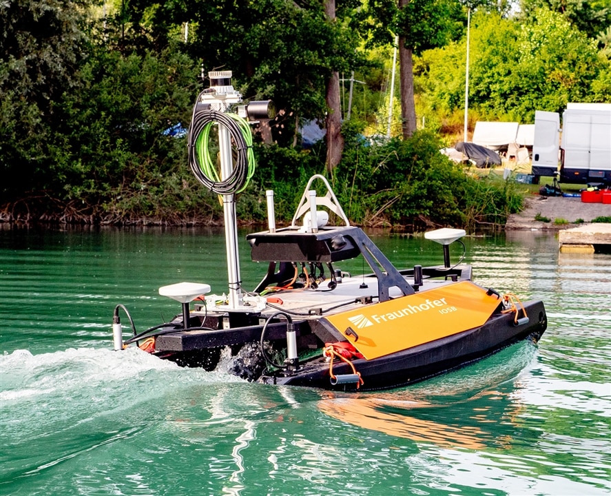
The team's vessel surveys above and below water surfaces and generates 3D maps. (Image Credit: Fraunhofer IOSB)
Authorities and port operators must produce updated maps of port facilities and riverbeds. Such a task typically involves using mapping vessels and lots of manpower. However, it's also costly and not being done regularly enough for future applications, including autonomous shipping. Fraunhofer IOSB researchers built an easily operable, pilotless watercraft designed to autonomously study bodies of water (above and below the water surface) and generate 3D maps at a depth of up to 100 meters.
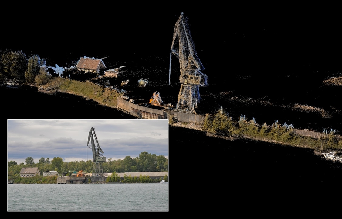
The team's watercraft relies on GPS, a Doppler velocity log (DVL) sensor, and acceleration and angular rate sensors to travel autonomously through the water. Data from these sensors are combined to direct the semi-automatic navigation system. Laser scanners and cameras work together with mapping software, generating precise 3D above-water maps of the surroundings. The system also uses a multi-beam sonar incorporated with the sensor system to produce 3D underwater maps of the bed.
"Our navigation system is semi-automatic in that the user only needs to specify the area to be mapped. The surveying process itself is fully automatic, and data evaluation is carried out with just a few clicks of the mouse. We developed the software modules required for the mapping and autonomous piloting," says Dr. Janko Petereit, a scientist at Fraunhofer IOSB.
First, the software picks out which regions to study before using that data to determine the route. Afterward, the 2m x 1.5m x 1m, 64kg watercraft powers up. As it moves around, the watercraft autonomously avoids obstacles that the laser scanner and sonar find. While traveling through the water, it creates a real-time 3D model for navigation, such as moving vessels. The software then computes an additional high-precision 3D model once the data has been evaluated. As a result, it maps the body of water's floor and the area above the water and keeps moving objects out of sight.

The watercraft used cameras and laser scanners to produce a 3D map of the bank structures. (Image Credit: Fraunhofer IOSB)
The team tested this prototype in various lakes. Currently, the Fraunhofer research group "Smart Ocean Technologies" is using the watercraft in Rostock for underwater and surface robotics projects.
This technology could be applicable in varying use cases. For example, it can autonomously excavate waterways and survey civil engineering structures and navigation channels. Of course, others who want to navigate bodies of water without generating maps can use the software stack. This could also lead to developing and deploying freight and passenger transport on high seas and inland waters."We will see a massive increase in autonomous shipping on German waterways in the future, culminating in new types of logistics chains that intelligently combine rail, road and water transport," Petereit says.
Have a story tip? Message me at: http://twitter.com/Cabe_Atwell
