


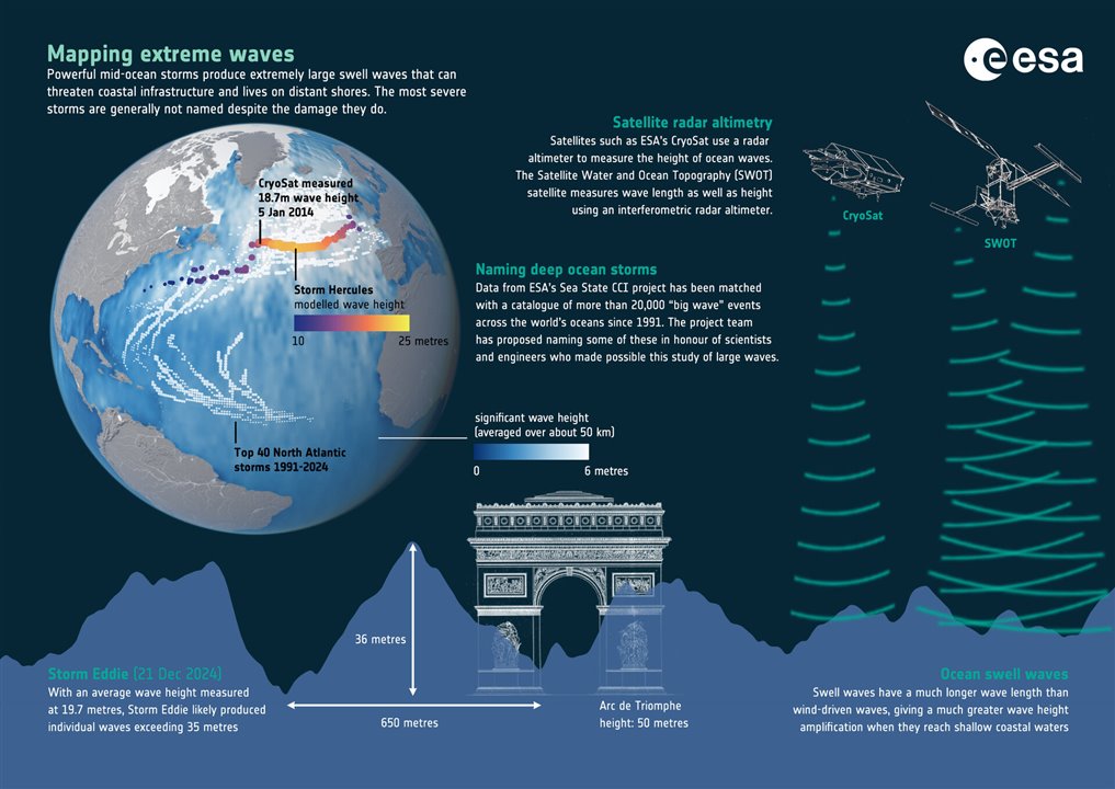
Storm Eddie produced an ocean wave that reached 19.7 meters tall. (Image Credit: ESA/Planetary Visions)
Ocean waves that grow to over twenty meters could threaten maritime safety, offshore infrastructure, and coastal communities. However, measuring the maximum height of these waves remains challenging due to the scarcity of direct measurements in remote storm centers. During storm Eddie on December 21, 2024, NASA and France’s Surface Water and Ocean Topography (SWOT) satellite detected a wave that grew to 19.7 meters as it peaked in the North Pacific.
Researchers relied on twenty months’ worth of data (April 2023 to December 2024) to track swells produced by Eddie and other major storms. By analyzing this long-term dataset, they demonstrated how wave echoes store storm energy, thereby allowing for indirect sizing of peak conditions thousands of miles away. As a result, the observed swells evolved over 14,000 miles, moving from the North Pacific core to the Drake Passage and tropical Atlantic. The analysis of spectral peaks revealed dominant wavelengths stretching from approximately 500 m near the storm to over one mile as the distance increased. Notably, previous models had estimated rogue waves up to 35 meters, even in the absence of super hurricanes.
SWOT uses its KaRIn radar interferometry to map sea-surface height across wide ocean swaths. KaRIn transmits Ka-band radar pulses toward the ocean surface, measuring phase differences between signals received by two antennas spaced 10 meters apart on a 15-meter boom. This results in 250-meter resolution maps. Such high resolution is sufficient for imaging swells longer than 500 meters (periods over 18 seconds) that cover two 31-mile-wide strips on both sides of the satellite track.
The team used 2D Fourier transforms with the elevation maps, transforming spatial patterns into swell spectra. These reveal wavelength, direction, and energy for each swell system. Tracing swell height decays and wavelength stretches over distance allowed the team to apply deep-water wave theory. Group velocity is associated with period to distance traveled. Meanwhile, energy preservation corresponds to observed power based on the storm’s peak conditions.
They also measured storm wave heights using nonlinear wave models that represent the energy shifting from short, steep waves to long swells. This corrected older formulas with inflated long-wave energy by a factor of 20. The Poseidon 3C nadir altimeter revealed a 19.7-meter storm wave height at the center of Storm Eddie, verifying the estimates from swell analysis.
Have a story tip? Message me here at element14.
