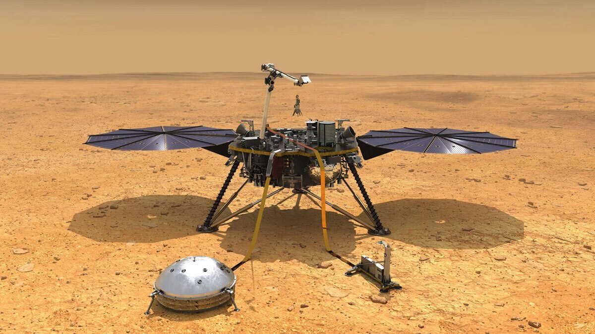
NASA’s InSight lander recorded the largest Marsquake on May 4th, 2022. (Image Credit: NASA/JPL-Caltech)
On May 4th, 2022, NASA’s InSight lander recorded the largest seismic event on Mars --- a 4.7 magnitude quake called S1222a. This one was also the longest, as the vibrations lasted six hours compared to the usual hour for many Marsquakes. And now we know why it happened. Scientists discovered a stress release within the planet’s crust is the fault of this record-breaking Marsquake, five times stronger than previous recordings, rather than an asteroid impact.
S1222a hit when the lander was completing its mission. Some onboard sensors were powered down to save energy because dust started blocking the solar panels. In turn, InSight’s power availability plummeted to fewer than 20% of its capacity. That meant the team had to rely on seismic data since it didn’t record wind and atmospheric pressure measurements.

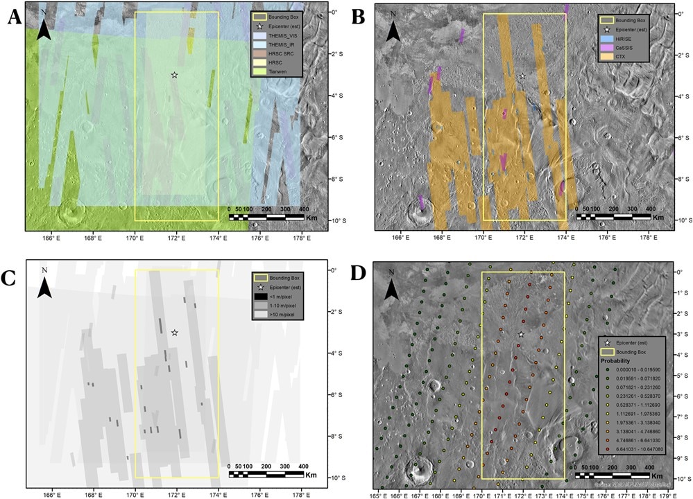
NASA scientists looked for an asteroid impact crater on Mars from these images. The star represents the expected crater site, while the rectangle is the search area. (Image Credit: Fernando et. al.)
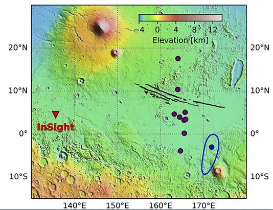
This quake, which hit 2,200km away from InSight, is comparable to meteor-related seismic activities on the red planet. That realization caused the team to search for a crater on Mars’s surface, and they came up empty-handed. They relied on data and images from before/after the quake that were obtained from Mars-orbiting satellites. According to the researchers, an asteroid impact causing the marsquake would have produced a 300m diameter crater and a blast zone of 180km across.
Although it’s difficult to distinguish between seismic activity and crater, the team identifies craters from a blast zone by capturing low-res images roughly after the meteor hit. High-res images are also required in this scenario to help them rule out an impact because a blast zone could also be hidden due to the terrain type. Additionally, the satellites don’t have many high-res images available, which presents a challenge. Their camera’s narrow fields of view mean that they only capture images of small regions at once. That suggests the team can’t study the areas before and after the crater formed because the images may not have been captured at that time.

This map reveals InsSight’s location (triangle) while the S1222a Marsquake hit (blue dot). (Image Credit: Kawamura et. al.)
So, the team solved this issue by observing all combined outputs from the Mars-orbiting missions. By using this approach, they didn’t discover any signs of an asteroid impact that would’ve caused the Marsquake. Instead, they believe stress release in Mars’ crust shook the region outside Cereberus Fossa, where tectonic activity occurs. Those stresses are formed by billions of years of evolution, such as different areas of the planet cooling/shrinking at various rates.

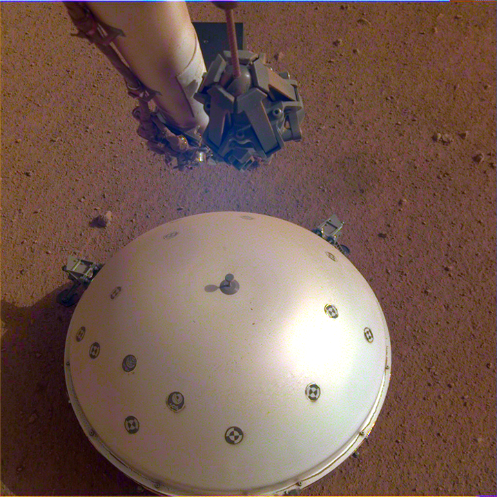
InSight’s SEIS instrument listens for seismic waves vibrating within Mars’ crust. (Image Credit: NASA/JPL-Caltech)
InSight captured seismic data using its seismometer called SEIS (Seismic Experiment for Interior Structure) set atop Mars’ surface to record seismic vibrations, giving scientists an idea of what’s going on within Mars. This instrument waited to detect those seismic waves that occur due to marsquakes and meteor impacts. The lander also carried wind, pressure, temperature, and magnetic field sensors that fine-tuned the SEIS measurements. By doing so, it detected vibrations produced by weather events like dust storms or atmospheric turbulence from seismic wave-generating dust devils.
Have a story tip? Message me at: http://twitter.com/Cabe_Atwell
