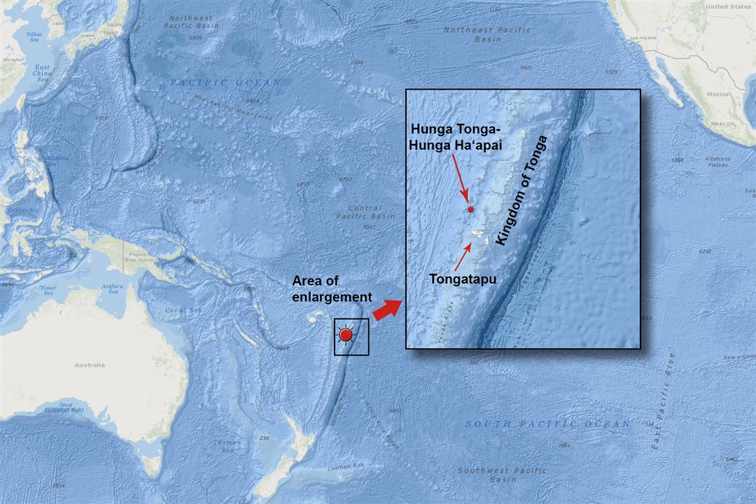
Map of the Hunga Tonga-Hunga Ha’apai underwater volcano in the Pacific Ocean. (Image CredutL The National Map, USGS)
On January 15th, 2022, the Hunga Tonga-Hunga Ha’apai underwater volcano erupted, prompting rare tsunami tidal effects across the Pacific Ocean. This grabbed the attention of the Okinawa Institute of Science and Technology’s (OIST) tsunami researchers, who observed the eruption’s energy output and how it impacted the ocean and atmosphere. They also made relevant contributions by developing a model that improves today’s tsunami early warning systems.
Typically, tsunamis displace a huge amount of water triggered by a rapid movement of the seabed due to an earthquake or a volcano eruption. The Tonga volcano eruption differed greatly because it released a huge pressure wave measuring hundreds of kilometers wide in the atmosphere. At first, it moved upwards before spreading outward, reaching an average speed of 1,141km/hour --- 400km/hour faster than a normal tsunami moving in deep water. It even went on a worldwide trip, forming waves in the Mediterranean Sea.
“Normally, a tsunami wave created in the Pacific would not reach the Mediterranean because it would have to travel around land masses to get there, but atmospheric waves are not restricted, traveling over those land masses,” Dr. Adel Sarmiento, a postdoc researcher, said.

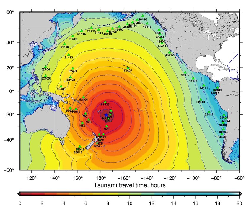
This image represents the estimated travel times of the tsunami caused by the Hunga Tonga-Hunga Ha’apai underwater volcano eruption. The colored bands represent hours after the eruption. (Image Credit: NOAA National Centers for Environmental Information)
Putting those speeds into perspective, the first waves reached Japan two hours earlier than expected. They also arrived in seas where landmasses would normally block out tsunamis. “This was the first event of its kind recorded in detail by modern instruments,” Prof. Emile Touber said.
The team validated their model by using the measurements from the Tonga event and dNami, an advanced code, to simulate the earth during that tsunami event via a supercomputer at OIST. With this code, the researchers can generate fine-resolution simulations quicker than in real-time, allowing them to improve warning systems. This method can also be used for hurricanes and tropical storms that cause water level changes, which affect coastlines.“With our model, we can explore what might happen to the water flow as it approaches the coast,” Emile Touber, the team’s lead researcher, said in the news release. “This can help [people] decide on the kind of coastal defense systems that should be put in place for storm related surges.”
Have a story tip? Message me at: http://twitter.com/Cabe_Atwell
